What Are Ley Lines? History, Evidence and the Mystery of the Old Straight Track
Ley lines began as Alfred Watkins' theory of ancient straight tracks. Explore their history, the evidence, Earth-energy beliefs and why the mystery persists.

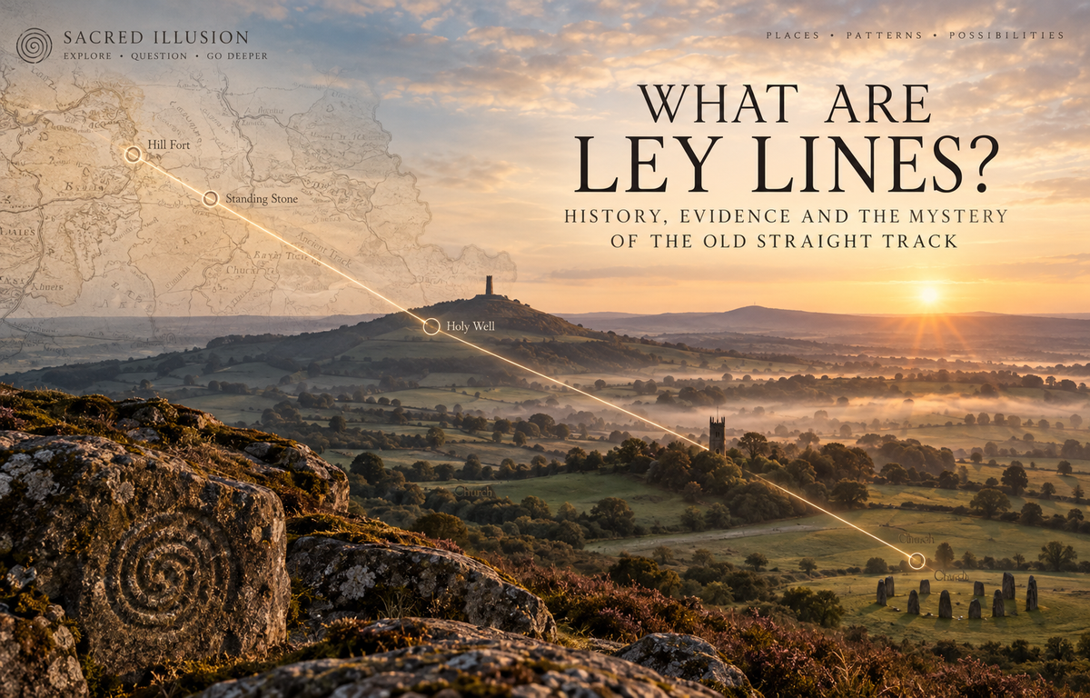
Draw a straight line across an old map of Britain and you may find something curious. A church tower. A prehistoric mound. A hill fort. A holy well. A standing stone. Another church.
Continue the line and more old places may appear to fall along it.
Coincidence? The remains of an ancient system of paths? A pattern created by the human mind?
Or, as later generations came to believe, evidence of invisible currents running through the Earth?
These proposed alignments are known as ley lines.
More than a century after the idea first appeared, ley lines remain one of the most persistent mysteries of the British landscape. They sit somewhere between archaeology, folklore, geography, spirituality and our apparently irresistible urge to find patterns in the places around us.
But there is an important complication.
The ley lines people talk about today are not quite the ley lines their originator imagined. To understand them, we need to go back to Herefordshire in 1921.
What is a ley line?
In its simplest form, a ley line is a proposed straight alignment between significant features in a landscape.
Those features might include:
- prehistoric monuments
- burial mounds and barrows
- standing stones
- hill forts
- old churches
- holy wells
- ancient tracks
- prominent hilltops
- crosses
- beacons
- other distinctive landmarks
The original theory was that some of these alignments represented remnants of ancient straight routes.
Later writers and practitioners developed a different idea: that ley lines were not merely routes but channels of subtle or spiritual energy, connecting sacred places across the landscape.
Today the term is used for both. A landscape alignment and an invisible energy current are two different claims.
One can be mapped geographically. The other remains a spiritual or metaphysical interpretation.
Alfred Watkins and the birth of the ley line
The modern story begins with Alfred Watkins, a Herefordshire businessman, photographer, inventor and antiquarian.
Watkins knew his local landscape unusually well.
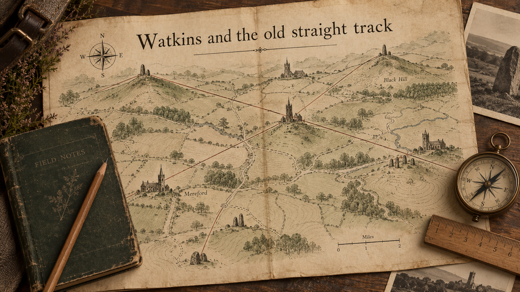
In 1921, while studying a map of Herefordshire, he became convinced that ancient sites and distinctive landscape features repeatedly fell into straight alignments.
The experience was sufficiently striking that he began investigating it systematically. He later described the principle through the image of a line stretched across the landscape, touching high places and significant points along its route.
Watkins presented his ideas to the Woolhope Naturalists' Field Club in Herefordshire in 1921. His theory was not that prehistoric Britain possessed a secret electrical grid.
He believed he had found traces of an ancient system of straight trackways.
Before maps, road signs and modern engineered roads, Watkins imagined travellers navigating between visible landmarks.
A prominent hill, mound, grove or standing stone could act as a sighting point. Later structures, particularly churches and crosses, might sometimes preserve the importance of sites that had been significant much earlier.
Watkins developed these ideas in Early British Trackways and, most famously, The Old Straight Track.
The phrase ley line eventually became attached to these proposed routes.
Watkins was not describing Earth energy
This is perhaps the most important thing to understand about the history of ley lines. Alfred Watkins' original theory was essentially geographical and archaeological, not supernatural.
He thought people had moved through ancient Britain using systems of aligned landmarks. That theory was controversial enough. The idea that ley lines carried mysterious forces through the Earth arrived later.
This is why modern conversations about ley lines can become confusing. Several different theories have accumulated beneath the same name.
Someone talking about a ley may mean:
- an ancient straight route
- a visual alignment between monuments
- a sacred or ceremonial axis
- an astronomical alignment
- a path identified through dowsing
- a supposed current of Earth energy
- part of a proposed global geometric grid
Those claims require very different kinds of evidence. Sacred Illusion treats them separately rather than assuming that proving one would automatically prove the others.
Why did Watkins think the lines were real?
Watkins noticed that certain types of landscape feature seemed repeatedly to align.
His proposed "mark points" included prominent hills, mounds, standing stones, ancient trees, wells, churches, castles and other structures. To Watkins, these were not isolated curiosities. Together they appeared to form routes.
His argument was partly practical. If travellers needed to cross a largely unmapped landscape, moving towards visible points could provide a simple navigational system.
He also believed later structures could preserve much older landscape relationships. A medieval church standing on a particular hill, for example, might occupy a location whose significance predated Christianity. That idea remains attractive today. But attraction is not evidence.
The archaeological challenge is establishing whether sites on a proposed line genuinely belonged to the same period, served related purposes or were intentionally connected.
A line can pass through real ancient places without the line itself being ancient.
The problem of chance
This is the central objection to ley-line theory. Britain contains an extraordinary density of archaeological sites, churches, settlements, wells, hills and historic structures.
Put enough points onto a map and straight lines will inevitably connect some of them. Two points are meaningless in this respect because any two points create a straight line. Add a third and the alignment becomes more interesting.
But even three, four or five sites may occur by chance when the number of possible starting points is large enough.
There is another problem.
The person drawing the line usually decides:
- which sites count
- which sites do not
- how old a site needs to be
- how far a point can sit from the line
- how wide the line itself is
- where the line begins and ends
These choices create enormous room for unconscious selection. A researcher might notice four sites that fit beautifully and overlook twenty nearby sites that do not. That does not mean every apparent alignment is meaningless.
It means geometry alone cannot establish intention.
So does archaeology reject ley lines?
Mainstream archaeology has not accepted Watkins' broad network of prehistoric straight tracks as an established feature of ancient Britain.
That does not mean ancient people ignored alignment, direction or landscape. Quite the opposite. Archaeology contains many well-established examples of monuments deliberately oriented towards astronomical events, landscape features or other structures.
Ancient roads existed. Ceremonial avenues existed. Sightlines mattered. Sacred landscapes existed.
Individual alignments can therefore be real and intentional without establishing that an enormous ley-line network existed across the country.
This distinction is important. The useful question is not: "Do straight ancient alignments exist?" They do.
The harder question is: "Does a particular alignment demonstrate the kind of system proposed by ley-line theory?"
That has to be investigated case by case.
Ancient cultures really did organise sacred landscapes
Another source of confusion is that some cultures demonstrably created systems connecting sacred places. The Inka ceque system around Cusco is a good example.
Imaginary lines radiated from the sacred centre of the city and connected numerous shrines, known as huacas, across the surrounding landscape.
These lines formed part of a sophisticated religious, social and calendrical system. That is fascinating. But ceques should not simply be renamed "Inca ley lines".
We know about the ceque system through its particular cultural and historical context. Ley lines are a modern British theory.
Similarities between traditions can be explored without pretending that different cultures were describing the same hidden global system.
That distinction allows comparison without erasing cultural difference.
How ley lines became mystical
Watkins died in 1935, but his idea did not disappear. During the decades that followed, the concept gradually moved beyond the theory of ancient trackways.
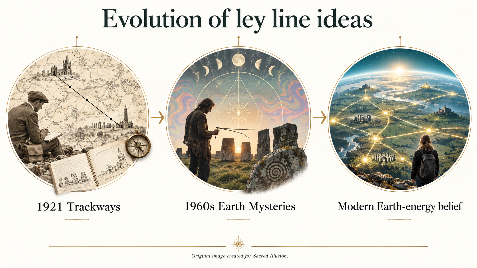
By the 1960s and 1970s, Britain was experiencing a renewed fascination with archaeology, alternative spirituality, unexplained phenomena, ancient wisdom and the possibility that modern society had lost ways of understanding the landscape.
Ley lines were ready for reinvention. Writers began connecting them with:
- dowsing
- UFO phenomena
- sacred geometry
- geomancy
- ancient astronomy
- Earth energies
- unusual magnetic effects
- psychic experience
- sacred sites
One of the most influential figures in this transformation was John Michell.
His 1969 book The View Over Atlantis combined ancient monuments, sacred geometry, astronomy, esoteric philosophy and the idea of a forgotten system of sacred landscape knowledge.
The old straight track was becoming something different. The Earth Mysteries movement was emerging.
From trackways to Earth energy
In modern spiritual use, ley lines are often described as something resembling the meridians of a living planet. Within this worldview, the Earth possesses an energetic anatomy.
Ley lines carry energy through it.
Places where lines intersect may be described as nodes, power places or vortexes.
Sacred sites are sometimes interpreted as structures positioned deliberately upon these energetic concentrations.
Places including Glastonbury, Avebury, Stonehenge, Sedona, Mount Shasta and many others have been incorporated into different versions of this idea.
There is currently no established scientific evidence demonstrating that such a global network of subtle energy lines exists.
That does not mean the spiritual tradition surrounding them is imaginary in the cultural sense.
People genuinely practise dowsing, meditate at proposed nodes, walk claimed ley routes and report powerful experiences at particular places.
Those experiences belong to the story of ley lines too. They simply represent a different category of evidence.
Ley lines, dowsing and personal experience
Dowsing became closely associated with ley hunting during the twentieth century. Practitioners may use rods or pendulums to identify what they experience as changes in the energetic character of a landscape.
Some describe rods crossing at particular points.
Others report bodily sensations such as tingling, warmth, pressure, calm or heightened awareness.
These experiences can be meaningful to the people having them. They do not, by themselves, demonstrate what caused them.
Dowsing tools can move through the ideomotor effect, where tiny unconscious muscular movements produce visible motion. Environmental conditions, expectation and prior knowledge may also influence what someone experiences at a sacred place.
The Sacred Illusion approach is therefore not to dismiss the experience or automatically accept its proposed explanation.
Instead: Record what happened first. Interpret it second.
"My rods crossed at the same place three times" is an observation.
"There is an invisible planetary energy current here" is an interpretation.
Keeping those statements separate makes the investigation more useful.
What about magnetic fields and geology?
This is another area where ley-line discussions often become muddled. The Earth unquestionably has a magnetic field.
Rock types can have different magnetic properties. Geological faults exist. Underground water exists. Local electromagnetic conditions can vary. None of those facts demonstrates the existence of ley lines.
If an unusual magnetic reading occurs at a sacred site, it may be interesting to investigate.
But the next step should be to look for ordinary physical explanations rather than assuming the instrument has detected a ley.
A measurable geological phenomenon and a metaphysical Earth-energy system are not interchangeable concepts.
This is particularly important because older ley-line literature sometimes uses scientific language to give spiritual ideas an appearance of scientific confirmation.
Interesting analogy is not the same thing as evidence.
The St Michael Line
Probably the best-known claimed ley line in Britain is the St Michael Line.
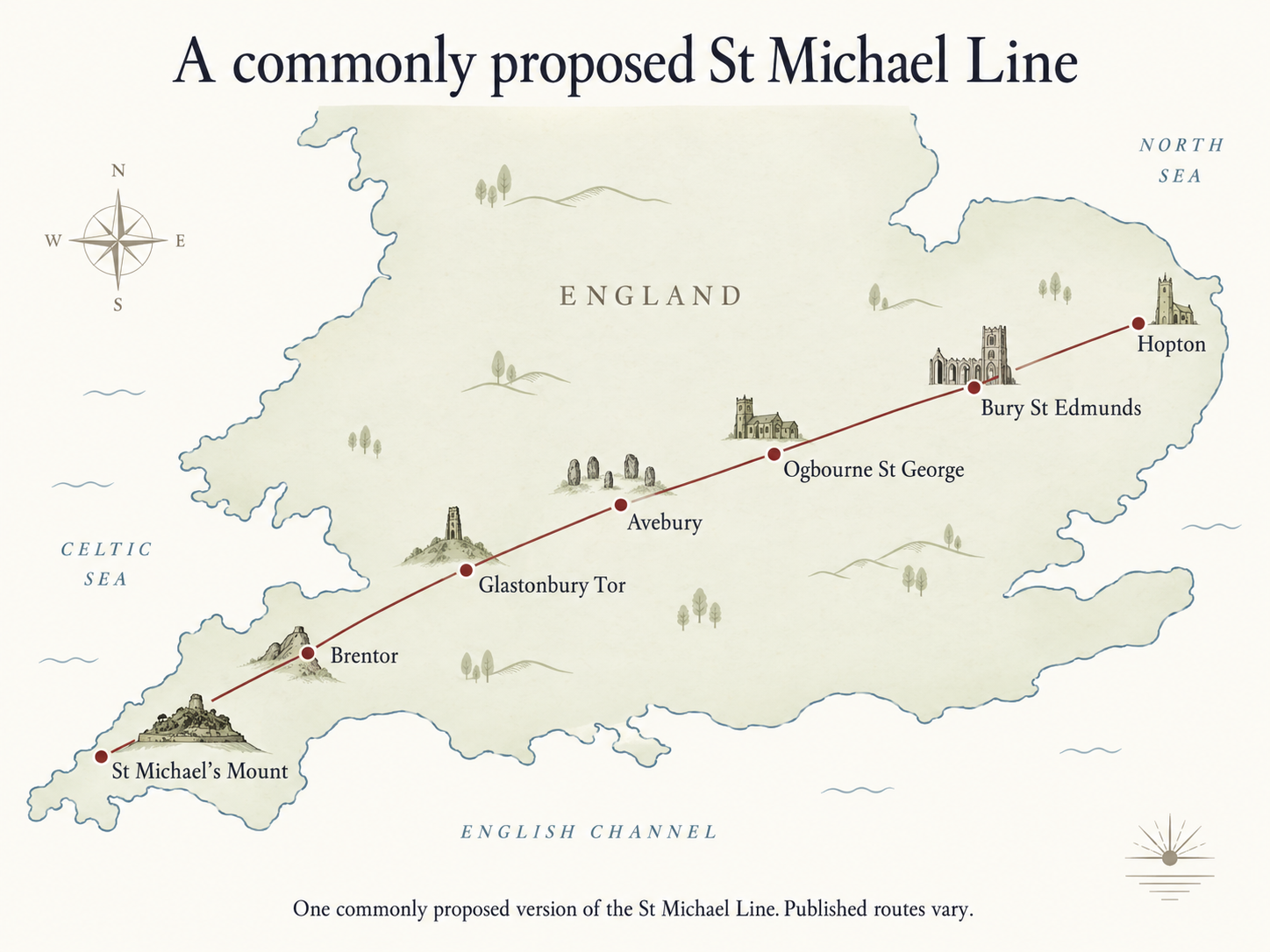
Different versions run across southern England, linking or passing near places including St Michael's Mount, Glastonbury and Avebury.
Several sites associated with the alignment are connected with St Michael, the Christian archangel traditionally depicted defeating a dragon.
Later earth-mystery traditions gave this symbolism another interpretation.
The dragon became associated with currents or powers in the landscape, and the line became part of a wider spiritual geography of southern Britain.
Dowsers Hamish Miller and Paul Broadhurst later described winding Michael and Mary currents associated with the broader alignment.
These should not be confused with a single precisely agreed geographical line.
There are multiple versions.
That makes the St Michael Line a particularly useful example of how ley-line ideas evolve.
There is:
- the physical geography
- the historic places
- Christian symbolism
- folklore
- astronomical interpretations
- modern dowsing
- earth-energy belief
All layered over the same landscape. The interesting question may not be whether every layer proves the others. It may be why the same places repeatedly attract new layers of meaning.
Ley lines and sacred geometry
Ley-line theory also became connected with sacred geometry. Researchers and esoteric writers have drawn triangles, circles, great circles, Platonic solids and other geometric structures between important sites.
Some of these patterns are striking.
But global geometry creates an even larger version of the same statistical problem encountered on a local map. There are thousands of ancient and sacred places from which to choose.
With enough sites, enough geometric forms and enough tolerance around a line, remarkable-looking patterns can emerge.
Proposed systems such as the Becker-Hagens planetary grid belong within the history of Earth Mysteries and modern esoteric thought.
They are intriguing models. They are not established maps of a scientifically demonstrated planetary energy network.
We will explore those ideas separately in The Earth's Energy Grid: Ley Lines, Nodes and the Networked Planet.
Are ley lines the same as dragon lines, fairy paths or Songlines?
No. This comparison appears frequently in popular writing about ley lines and needs much more care.
Chinese geomantic traditions, European fairy lore, Indigenous Australian Songlines, Inka ceques and British ley-line theories arise from different cultures with different histories and meanings.
They may share themes such as landscape, direction, sacred place, journey and relationship with the land. That can make comparison fascinating.
But similar themes do not prove that every culture discovered the same invisible energy grid. In particular, Aboriginal Australian Songlines are living cultural traditions connected with Country, ancestry, law, knowledge and navigation.
Reducing them to evidence for a Western ley-line theory strips away much of what makes them significant. Sacred landscapes may be close to universal.
A universal theory of ley lines is something different.
Why are ley lines still so compelling?
This may be the most interesting question of all. Ley lines have survived more than a century of criticism because the idea touches something deeper than cartography.
They suggest that place might mean more than location.
Modern life often treats landscape as space to cross, develop, measure or own.
Older sacred traditions frequently treat particular hills, springs, stones, caves, groves and pathways as possessing identity and meaning.
Ley lines offer a modern language for recovering that sense of connection. They also appeal to a very human instinct.
We look for patterns. Sometimes pattern recognition reveals something real. Sometimes it creates relationships that are not there. Often the interesting work lies in discovering which is which. Perhaps that is why ley hunting remains compelling.
It turns a passive landscape into a question.
- Why is that church there?
- What stood there before it?
- Why was that mound placed on that ridge?
- Can the next hill be seen from here?
- Where does this old track actually lead?
- What happens if I follow the line?
Those are good questions even if no hidden current of energy is ever found.
So, are ley lines real?
The answer depends upon what we mean by "ley line".
Do significant places sometimes form straight alignments?
Yes.
Did ancient people deliberately create routes, sightlines and relationships between places?
Certainly in some cases.
Did Alfred Watkins identify a proven nationwide network of prehistoric straight tracks?
No. His wider theory remains disputed and has not been accepted as established archaeology.
Has science demonstrated an invisible network of Earth energy linking sacred sites?
No.
Do people continue to experience, map, dowse and spiritually interpret these landscapes?
Absolutely.
Those four answers can coexist.
We do not need to choose between "ley lines prove a hidden planetary grid" and "there is nothing interesting here".
There is a much richer territory in between. And the possibility that looking more closely at the places around us may reveal something, even if it is not what we expected to find.
How to explore ley lines yourself
If this has made you want to take out a map, that is exactly where the next part of Sacred Illusion's ley-line investigation begins.
Read How to Find Ley Lines Near You: Maps, Methods and Fieldwork for a practical method using maps, archaeological records, Google Earth and field observation.
The aim is not to draw a line and then prove yourself right.
It is to draw the line, investigate what it connects, walk the landscape and see how much the pattern can honestly carry.
For the wider theory, continue with The Earth's Energy Grid: Ley Lines, Nodes and the Networked Planet, where we explore planetary grids, energy nodes, sacred geometry and the evidence behind the claims.
And through future Node Quests, Sacred Illusion will take some of these ideas out into the landscape itself.
Frequently asked questions
Who invented ley lines?
The modern ley-line theory was developed by Alfred Watkins, a Herefordshire businessman, photographer and antiquarian. In 1921 he proposed that ancient landmarks across the British landscape formed straight alignments representing old trackways or routes.
Did Alfred Watkins believe ley lines were energy lines?
No. Watkins' original theory concerned ancient straight tracks and aligned landscape markers. The idea that ley lines carried subtle Earth energy developed later through dowsing, esoteric writing and the Earth Mysteries movement.
Are ley lines scientifically proven?
No scientific evidence has established the existence of a global network of invisible energy lines connecting sacred sites. Individual intentional alignments between ancient structures certainly exist, but this does not prove a wider ley-line system.
Why are churches often found on ley lines?
Many claimed ley lines pass through churches because churches are old, prominent and extremely numerous across Britain. Some occupy sites with earlier histories, but this must be investigated individually rather than assuming every church replaced a prehistoric sacred site.
What is the most famous ley line in Britain?
The St Michael Line is probably Britain's best-known claimed ley line. Different versions connect or pass close to major sacred and prehistoric locations across southern England, including St Michael's Mount, Glastonbury and Avebury.
What is the difference between a ley line and an Earth energy grid?
A ley line usually describes a proposed alignment between significant places. Earth-grid theories go further, proposing a larger network of energetic or geometric relationships covering the planet. We explore those theories separately because they make additional claims beyond Watkins' original idea.
Can you feel a ley line?
Some practitioners report physical, emotional or intuitive sensations at locations they associate with ley lines. Such experiences are subjective and do not scientifically demonstrate the existence of an external energy line. They can still be recorded and investigated as part of personal fieldwork.
Continue exploring
How to Find Ley Lines Near You: Maps, Methods and Fieldwork
Take the theory into the landscape using maps, archaeological records and field investigation.
The Earth's Energy Grid: Ley Lines, Nodes and the Networked Planet
Explore the larger idea that sacred places form part of a planetary network.
Sacred Places
Explore sacred places, pilgrimage, landscape mysteries and future Sacred Illusion Node Quests.